Online Risk Assessment
Description:
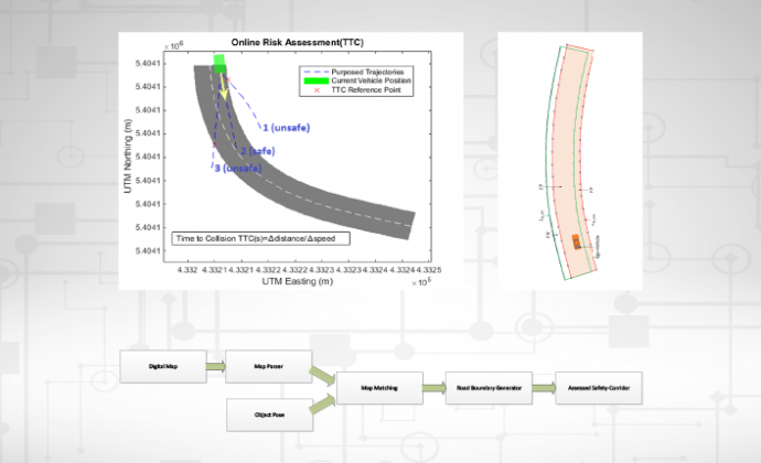
Calculating safe and feasible trajectories for the TeamMate car requires a safety corridor that needs to be within the boundaries of the road and free from dynamic objects. Using satellite navigation allows localizing a car on a map, but
the location retrieved will be inaccurate due to blocked or distorted satellite signals. The uncertainty information associated with the satellite navigation system can be used to estimate the corridor within the road boundaries which can still be considered safe, conditional on the current uncertainty and a user-provided acceptable risk threshold. The module can then quantify the risk of trajectories planned by the TeamMate car based on the uncertainty of the localization. The
risk quantification is based on the time-to-collision safety surrogate measure.
Where is it integrated?
VED vehicle demonstrator
Click here to download the description of all the AutoMate Enablers.